The public consultation document is at this link https://new.devon.gov.uk/planning/planning-policies/other-county-policy-and-guidance/south-hams-sac-spd-consultation I’d recommend you compare this with the current SAC planning protection zone (as we don’t want to lose any protection!) http://www.devon.gov.uk/core-doc-y1-greater-horseshoes-bat-…. Do it for the bats – our wildlife needs all the help it can get (50% of the UK’s wildlife has disappeared in the last 50 years).
THE CLOSING DATE FOR SUBMISSIONS IS 13th JUNE 2018 at 5pm
This is my response to the consultation:
Part B: Representation (n.b. public consultation questions followed by my responses). See also below some template questions you might like to use in making your own submission. Feel free to recycle some of the points I have made in my submission if you wish.
| Q1. Is the Draft Supplementary Planning Document clearly structured and legible? |
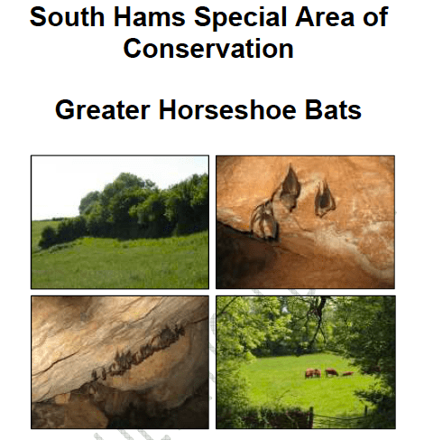
| The Introductory (boxed) statement regarding the status and importance of Greater Horseshoe Bats (GHBs) appears on Page 7 of this document. Whilst it is appreciated that the early pages of the document outline the proposals, application and next steps, it would have been useful to set the context for the entire raison d’etre of this document to repeat this box on the first page of the document (perhaps below the four photographs where it could have been squeezed in).
Otherwise the way that the document has been put together is clear and helpful to understanding the issue and for the unfamiliar it provides clear information about GHB, their needs and habitat requirements. However the absence of the previous document The Special Area of Conservation (SAC) Planning Zone guidance makes it more difficult for comment based on comparison between the two documents that it is now proposed to move between. It is appreciated that the maps that were part of the previous/current SAC Planning Consultation Zone were made available at the recent workshops and discussed alongside the proposed SPD but these should be included on the current (albeit difficult to find) public consultation proposals or at least a web-link provided to them.
|
| Q2. Do you agree with the proposed approach to replacing Strategic Flyways with the Landscape Connectivity Zone? If not, why not? |
| I do not agree with replacing the Strategic Flyways with the landscape connectivity zone (LCZ). I think we need both the Strategic Flyways and the new LCZ in the proposed SPD.
While I understand that the rationale for the removal of the flyways is attributed to the need for more widespread protection across the entire area that GHBs actively use for sustenance and foraging, it is well known and documented that they use the natural lines along waterways, tree lines and similar routes that are identified as their flyways for navigation. When development proposals are considered by LPAs they talk about mitigation, which generally assumes that GHBs will ‘make do’ with some Bat Boxes and / or find another area or flyways to use. These same areas designated for mitigation can be used and reused by different development proposals, in particular in areas where extensive urbanisation is being developed, such that the overused mitigation area becomes a pinch point; this could provide inadequate habitat or sustenance, foraging etc for the increased numbers of GHBs plus all the other wildlife that will be moved out by the development proposals and expected to survive with that reduced space. Certainly the major wildlife losses (50%) over the past half a century indicate that this is occurring to the detriment of our wildlife and we should ensure that we put in place workable mitigation and (in line with the emerging JLP) require measures that enhance biodiversity. GHB do not exist in isolation from the rest of the fauna and flora that occupy their habitats. GHB are dependent on the network of the natural environment they live alongside and that habitat, previously identified as their Strategic Flyways must be protected as key wildlife corridors as well this new and additional provision of protection of the open spaces including farmland and the edges of the more built up areas of South Devon that they are also known to inhabit. The Strategic Flyways should be given enhanced protection not only to ensure that there is a rich network of natural habitat that supports GHBs but also ensures links between the SACs to prevent any of them being ‘cut off’ and turned into fragile islands of this already endangered species. I understand that there is a deficit of ecological surveys to support some of the current Strategic Flyways and indeed this will apply to the proposed wider LCZ, however rather than allow this lack of information to be to the detriment of areas that need protection, it would be the benefit to the GHB population and to the wider support and enhancement of biodiversity in South Devon to seek ways to increase the ecological knowledge of the area. The public are often keen to be involved in local surveys and the Devon Bat Project has carried out excellent work in the past few years with bat surveys that the public can participate in. I would suggest that this work is supported and mapped as part of the SPD to enable it to be updated and grow as more information from new surveys is incorporated into the knowledge. I would further suggest that ecological surveys carried out by developers as part of their planning applications are also logged and mapped in this way (this would not mean that additional new surveys can be required for further developments in or around the same site). Bringing all this information together could dramatically increase our knowledge, understanding and ensure the best possible protection for GHBs as well as all the other species of bats (that are also protected in this area) and the wider wildlife including other protected species such as EU protected Hazel Dormice. Ref 2.2.14 The term Existing Mitigation Features would be better replaced with Existing Sensitive Habitat Features as the latter provides a more informative approach to the feature. The use of the term Mitigation in the term suggests that mitigation is acceptable, although the document at 2.2.15 suggests that any impacts could have a likely significant effect and would require an HR, i.e. still providing a positive approach to mitigation, a step that could give false hope to a potential development and could be a location where it could be totally inappropriate to allow disturbance or intrusion of a sensitive and important GHB habitat.
|
| Q3. Do you agree with the proposed boundary of the Landscape Connectivity Zone and Sustenance Zones shown on Figure 1 (also available online at: http://map.devon.gov.uk/DCCViewer/) If not, why not? |
| The map with the new proposals illustrates a number of GHB roosts outside of the LCZ. These roots which are not designated as SAC have little protection with regard to sustenance, connectivity or flyways to support those bats using those roosts. It is my proposal that there should be an additional Buffer Zone that extends a further five Kilometres from the demarcation of the four kilometres LCZ i.e. a total of eight kilometres from the SAC / roost. This would broaden the area within which GHB considerations in the form of Preliminary Ecological Assessments (PEA) would be required for any proposed developments and require more detailed Ecological surveys as triggered within the LCZ. This would not only provide stronger habitat protection for the bats in the SACs and other roosts in the LCZ, but support connectivity and links with bats using the GHB roosts mapped outside of the LCZ and could help identify more roosts, sustenance and foraging areas and flyways through more ecological surveys being carried out. This would also be important to the areas where the LCZ is very narrow and extends hardly beyond the 4 km Sustenance Zone.
While I realise that some GHB roosts marked on this proposed map are not designated or protected as SACs, it would be to their advantage and assist with considerations and decisions on development proposals to have at least a minimum of a Sustenance Zone and an LCZ that connected them to other identified roosts together with any potential Strategic Flyways identified to ensure those GHBs are not lost through being cut off from other colonies. I think the LCZ should extend at least a minimum of 8km from the SSSI / SAC in all directions. It is not clear why the areas in particular to the North, South and West have been ignored in this way. I appreciate that these areas do not necessarily connect between the main SSSIs and SACs, but the GHBs will be using those areas and as outlined above there are additional roosts that are not currently designated as SSSI/SAC but will need protection for their interactions with the roosts with designated status |
| Q4. Does the Flow Chart help in clarifying which planning applications will require a Habitat Regulations Assessment? If not, how can this be improved? |
| It would be beneficial to all concerned to understand whether the HRA is a new proposal or to be more widely implemented by all LPAs in the areas mapped as SAC, Sustenance Zone and LCZ. The relationship between local Planning Application checklists that applicants consult and adhere to and the EIA and HRA documents and triggers that LPA planners complete and apply would be helpful for all concerned.
While the flow chart produced for this consultation reads well and clear it could be overly simplistic given the issues raised above with regard to the planning decision making process in practice |
| Q5. Does the document help to clarify the information which the Local Planning Authority require from the developer? If not, how can this be improved? |
| There is a lack of clarity in how major difference between the experience I have as a Member of the Planning Committees at South Hams District Council (SHDC) and Devon County Council (DCC) and the reference in this document regarding the triggers for a Habitats Regulations Assessment. At SHDC there is a Validation Checklist for all the documentation required for a planning application to go forward and in my experience just an Environmental Impact Assessment (EIA) Screening Opinion is carried out for Planning applications, further to which a Preliminary Ecological Assessment (PEA) is considered sufficient and no further ecological surveys are required (e.g the highly contentious 14/0142/15/F at Brimhay, Dartington does not have an HRA, just an EIA assessment although GHB and Hazel Dormice are known to be on site and the site sites within the current and proposed Sustenance Zone for GHB. Further to which a PEA was advised as sufficient (and the planning committee was advised that the SAC planning boundary was going to be moved back by 3km in 2017 and so that SAC Planning Consultation Zone would not apply – a misleading and incorrect statement).
The Joint Local Plan (JLP) for South Hams, West Devon and Plymouth 2014 – 2034 is currently in the late stages of development. This document as a Supplementary Planning Document will be advisory to the implementation of the JLP. To give it greater weight in planning decisions and therefore provide the level of protection that is within the detail and spirit of the EU Habitats Directive, I propose that this SPD is escalated to DPD (Development Plan Document) status, as advisory documents can be seen as less important to all parties trying to develop in areas where GHBs need to be fully protected. Either way and essentially on the potential impact of this document on the population of GHBs as an internationally and nationally protected species in South Devon, this proposed SPD / DPD should be subjected to an SEA (Strategic Environmental Assessment). It is regrettable that this important Local Pan that is at an advanced stage of development is not provided as a link in the listings at the end of the document. This SPD will (hopefully) provide strong material guidance to the JLP and should have been referenced in that context.
|
| Q6. Are the proposed arrangements for monitoring and review of the Supplementary Planning Document clear and appropriate? |
| There is a clear requirement for monitoring expressed in the document, however it would be more useful and probably more helpful to all concerned and provide a greater assurance of effective monitoring being carried out if some minimum requirements for this monitoring and who would be carrying this out were to be set out in in the SPD. Many development sites are sold on and/or their open space management is conducted by a separate management company once the site has been developed; therefore clarification of how the monitoring and the time scales for ongoing surveys needs to be set out.
Similarly the document’s requirements for mitigation prior to impacts is welcomed (but is currently not the case with new developments in my experience), I would therefore suggest that timescales and who would monitor this is clearly set out in the SPD to provide clear unequivocal guidance. Again, the public could be encouraged to be involved her and the important role of specialist NGOs such as Devon Wildlife Trust, Devon Bat group etc could be brought together here as part of the back-up for the monitoring. With encouragement and perhaps information and guidance Neighbourhood Plan groups could be important groups to also assist with monitoring GHBs in their parishes. Review of this SPD?? I could find no mention or reference to this in the document. |
|
Q7. Do you have any further comments? |
| It was disappointing that only planners and developers were invited to the special workshop prior to the public drop-in. (I understand one SHDC Ward Member was told not to attend). That workshop should have been clearly open to all Ward and Division Members across the area of the proposed plan to understand and contribute at the workshop and bring this understanding back to the public they represent who were unable to attend the public workshop. Far more public engagement and understanding of these proposals needs to be encouraged.
Although I pointed out at the public workshop that this public consultation and the associated documents are not easily accessible on DCC website (and was given assurance that this would be improved) it still takes at least 4 links to access the relevant page that carries documents to study and comment on. Despite being the main area that this will cover and having a live Local Plan currently being debated, SHDC does not even have any reference to this consultation that I could find on their website. Whilst it has been appreciated that an additional two weeks has been provided for submissions, the dates littered throughout the on-line pages and documents have both dates and are therefore confusing; please could this be amended before the close of the consultation as some potential commenters could be put off by thinking that they were too late to comment. I think this amounts to a serious lack of transparency in the public consultation for this important document. Please could this public consultation be more widely advertised and ALL the relevant documents be made more accessible and easily available asap i.e. BEFORE the close of the consultation to ensure a wide response from all stakeholders. The lack of reference to Neighbourhood Plans was disappointing; these are important groups and there are currently at least 28 parish wide groups actively putting together plans for their parishes in the South Hams alone. Their role and understanding of their areas, much of which is being enhanced through their work in developing their NHPlan could provide considerable and much needed additional evidence of wildlife including GHBs in their parishes. Understanding of wildlife, their habitats and biodiversity in general is often seen as a highly specialist subject and with the reduction in nature studies etc in primary education that is likely to increase that image and distance rather than encourage the public to become more involved in wildlife care. Many people are deeply concerned that we have lost 50% of our wildlife in the UK in the last 50 years and much of this is due to endless encroachment on wildlife areas and chipping away of important ecological habitats. The JLP mentioned above includes many references to Wildlife corridors but does not give further information in terms of how they can be identified, understood, surveyed, monitored or enhanced, nor is any provision of mapping these features included. South Devon is full of local people who would be very enthusiastic to be more involved in helping their local wildlife; I would therefore suggest a further SPD of Wildlife Corridors and important habitats to support this SPD and provide a basis for wider protection of all wildlife in South Devon.
|
Why not make your own submission (it really does help to show public support / concerns on these issues). I have put together some thoughts and questions that might help you make your submission:
| 1. Is the Draft Supplementary Planning Document clearly structured and legible? |
| Possible questions to ask yourself for response?
Do you feel informed about the context of this document and the relevance of the GHB as soon as you start reading the document? Is this document engaging and clear? Did you get lost in the document? Is it okay language /jargon wise Did you need more comparative documents including maps; i.e. regarding the document that this one will replace
|
| 2. Do you agree with the proposed approach to replacing Strategic Flyways with the Landscape Connectivity Zone? If not, why not? |
| Key points raised:
Do we need both the Strategic Flyways and the new LCZ in the new SPD? Would this ‘broad brush approach to the wider area be to the detriment of the GHBs (and other wildlife)? Perhaps the Strategic Flyways should also be known as Wildlife Corridors? What protection do you think the GHBs and other wildlife need in these areas called LCZ? Should the Strategic Flyways be given enhanced protection? Is Mitigation (when wildlife is directed to use elsewhere, e.g. bat boxes, new planting) working? Should we be seeking enhancement of wildlife areas to increase biodiversity?
|
| 3. Do you agree with the proposed boundary of the Landscape Connectivity Zone and Sustenance Zones shown on Figure 1 (also available online at: http://map.devon.gov.uk/DCCViewer/) If not, why not? |
| The map with the new proposals illustrates a number of GHB roosts outside of the LCZ. These roots which are not designated as SAC have little protection with regard to sustenance, connectivity or flyways to support those bats using those roosts.
Should these non-designated roosts also have more protection? Should there be an additional Buffer Zone that extends a further X Km from the demarcation of the four kilometres LCZ i.e. a total of eight kilometres from the SAC / roost. How could we get more information about GHBs in this area? Do we need to require developers for more surveys? Are the SAC Bat Roosts and the habitats they depend on adequately protected? Are their links and protected zones identified and adequate to ensure those GHBs are not lost through being cut off from other colonies? |
| 4. Does the Flow Chart help in clarifying which planning applications will require a Habitat Regulations Assessment? If not, how can this be improved? |
| Do you think that the relationship between local Planning Application checklists that applicants consult on and adhere to and the EIA and HRA documents and triggers that LPA planners complete and apply are adequately explained and their relationship made clear?
Is the flow chart overly simplistic? How likely do you consider it will be fully and satisfactorily implemented?
|
| 5. Does the document help to clarify the information which the Local Planning Authority require from the developer? If not, how can this be improved? |
| Does the information and explanations herein match any experience you may of planning decisions that have been made in places where GHBs are known to exist?
Did you consider that there was adequate protection in place and does this document enhance or detract from that protection? Do you consider that the Joint Local Plan as an emerging Planning document for South Hams, West Devon and Plymouth 2014-2034 should have been given more prominence and clear links of how this SPD is likely to advice and provide strong guidance with regard to that document? Given the potential impact of this document on the population of GHBs as an internationally and nationally protected species in South Devon, do you consider that this proposed SPD / DPD should be subjected to an SEA (Strategic Environmental Assessment) (page 3 says not)?
|
| 6. Are the proposed arrangements for monitoring and review of the Supplementary Planning Document clear and appropriate? |
| Do you feel confident that monitoring is clearly explained and adequate to ensure that mitigation measure proposed will be measured over a long period to ensure the furture of GHBs is not being compromised by development plans that are given approval?
How do you think this could be done when many development sites are sold on and/or their open space management is conducted by a separate management company once the site has been developed? Do you think timescales for monitoring are adequately explained? Could the public be encouraged to be involved her and the important role of specialist NGOs such as Devon Wildlife Trust, Devon Bat group etc could be brought together as part of the back-up for the monitoring? Would there be a role for Neighbourhood Plan groups to be involved with monitoring GHBs in their parishes? Could you find mention of Review of this SPD?
|
| 7. Do you have any further comments? |
| Did you know about the workshops on May 1st?
Did you attend? Was this / would this have been helpful? Were you able to easily find this consultation and all the documents you needed on a website? Do you think that Parish and Ward Councillors and Neighbourhood Plan groups should have been invited to attend a workshop? Anything else you want to say? |
